| NWS Local Storm Reports |
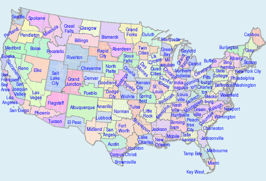
To Select Another NWS Office Click on Map or Choose from List

|
| Versions: 1 2 3 4 5 6 7 8 9 10 11 12 13 14 15 16 17 18 19 20 21 22 23 |
| Omaha NE 3 storm reports |
| 4 MILES WEST-SOUTHWEST OF Platte Center | |||||
| Tornado EF-0 Tornado. This tornado track is based entirely off of eyewitness reports as there was no damage indicated along the entirety of the intermittent track. Emergency management, storm spotters, and video evidence indicate that the tornado began approximately 3 miles southwest of Platte Center. it moved northeast where it crossed the Central Highway road a half mile east of 325th avenue. From that point on, it became more intermittent, occasionally kicking up dust at the ground underneath the persistent funnel cloud. There were times, especially during the intermittent phase, when the ground level circulation went through center pivot irrigation systems without tipping them over, which has stood as the basis for rating this as an EF-0 tornado. Video evidence suggests that it was approximately 50 yards wide at its maximum width. The total track length was approximately 8.4 miles. |
|||||
| DATE 04/16/2024 |
TIME 11:35 AM |
COUNTY Platte |
STATE NE |
SOURCE NWS Storm Survey |
GEOGRAPHIC 41.52N 97.55W |
| 2 MILES SOUTH-SOUTHWEST OF Creston | |||||
| Tornado EF-0 Tornado. A tornado began just west of 190th avenue and about a half mile north of 445th street where it flipped a cattle shed. The tornado then tracked toward the northwest, where it impacted another farm, flipping over a small outbuilding and removing roofing material of another outbuilding. A large cedar tree was also split down the middle. From this point, the tornado tracked north and then eventually east. Another farm was impacted near 190th avenue and 475th street where a detached garage had the roof removed and walls collapsed. Another cattle shed was overturned near the end point of the tornado near 475th street and 182nd avenue. There were several videos of this tornado which indicate an interesting evolution. It seemed to begin as the parent storm ingested rotation from a weak frontal boundary extending southeast of the storm, then pulled the tornado northwest closer to the storm updraft, and then eventually it turned to move northeast in the same direction as the storm and eventually pushed a bit more toward the east as a cool gust pushed out and dissipated the tornado. While the funnel cloud was rather wide at times, the actual contact with the ground was quite narrow, as evidenced by the narrow damage track. |
|||||
| DATE 04/16/2024 |
TIME 12:37 PM |
COUNTY Platte |
STATE NE |
SOURCE NWS Storm Survey |
GEOGRAPHIC 41.68N 97.37W |
| 7 MILES SOUTH-SOUTHWEST OF Howells | |||||
| Tornado EF-0 Tornado. Detailed reports from a combination of emergency management, eyewitnesses, and video evidence from storm spotters indicates this as the path of the tornado. Eyewitness accounts indicate that the final 1.5 miles of the track were intermittent, with occasional debris and dust at the ground level. These reports also indicate that the tornado began at 1:39 PM and lasted for approximately 10 minutes, which aligns well with the storm motion. There were at least 2 center pivots damaged along the track, and some minor damage to small outbuildings where tin roofing material was removed. These damage indicators and the degree of damage indicate that the tornado was an EF-0 with maximum winds of approximately 75 mph. Video evidence of the dust field suggests a width of approximately 40 yards. |
|||||
| DATE 04/16/2024 |
TIME 1:39 PM |
COUNTY Colfax |
STATE NE |
SOURCE NWS Storm Survey |
GEOGRAPHIC 41.62N 97.04W |