Select NOAA-NWS Forecast Office Text Products

(Product availability varies with seasons, forecast office, and weather.)

Hazardous Weather Outlook for Binghamton, NY

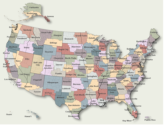
To Select Another NWS Office Click on Map or Choose from List

County Warning Area MAP
Select Forecast Office:   Select Product:  
694
FLUS41 KBGM 140942
HWOBGM

Hazardous Weather Outlook
National Weather Service Binghamton NY
442 AM EST Fri Feb 14 2025

NYZ045-046-057-062-PAZ040-048-072-150945-
Chenango-Otsego-Delaware-Sullivan-Northern Wayne-Pike-Southern Wayne-
442 AM EST Fri Feb 14 2025

...WINTER WEATHER ADVISORY IN EFFECT FROM 11 AM SATURDAY TO 1 PM EST
SUNDAY...

This Hazardous Weather Outlook is for central New York and
northeast Pennsylvania.

.DAY ONE...Today and tonight.

Hazardous weather is not expected at this time.

.DAYS TWO THROUGH SEVEN...Saturday through Thursday.

Please listen to NOAA Weather Radio or go to weather.gov on the
Internet for more information about the following hazards.

   Winter Weather Advisory.

Strong west-northwest winds are expected Sunday night into Monday
between 35 to 45 mph or locally higher. Wind headlines may be needed
if confidence increases in these very windy conditions. Wind chills
as low as 15 below zero are also possible Monday into Tuesday.

.SPOTTER INFORMATION STATEMENT...

Weather spotters are encouraged to report significant weather
conditions according to Standard Operating Procedures. Please relay
any information about severe weather to the NWS.

$$

NYZ015>017-022>025-044-055-056-PAZ038-039-043-044-047-150945-
Yates-Seneca-Southern Cayuga-Steuben-Schuyler-Chemung-Tompkins-
Cortland-Tioga-Broome-Bradford-Susquehanna-Wyoming-Lackawanna-
Luzerne-
442 AM EST Fri Feb 14 2025

...WINTER WEATHER ADVISORY IN EFFECT FROM 9 AM SATURDAY TO 9 AM EST
SUNDAY...

This Hazardous Weather Outlook is for central New York and
northeast Pennsylvania.

.DAY ONE...Today and tonight.

Hazardous weather is not expected at this time.

.DAYS TWO THROUGH SEVEN...Saturday through Thursday.

Please listen to NOAA Weather Radio or go to weather.gov on the
Internet for more information about the following hazards.

   Winter Weather Advisory.

Strong west-northwest winds are expected Sunday night into Monday
between 35 to 45 mph or locally higher. Wind headlines may be needed
if confidence increases in these very windy conditions. Wind chills
as low as 15 below zero are also possible Monday into Tuesday.

.SPOTTER INFORMATION STATEMENT...

Weather spotters are encouraged to report significant weather
conditions according to Standard Operating Procedures. Please relay
any information about severe weather to the NWS.

$$

NYZ018-150945-
Onondaga-
442 AM EST Fri Feb 14 2025

...LAKE EFFECT SNOW WARNING REMAINS IN EFFECT UNTIL 1 AM EST
SATURDAY...
...WINTER WEATHER ADVISORY IN EFFECT FROM 9 AM SATURDAY TO 9 AM EST
SUNDAY...

This Hazardous Weather Outlook is for central New York.

.DAY ONE...Today and tonight.

Please listen to NOAA Weather Radio or go to weather.gov on the
Internet for more information about the following hazards.

   Lake Effect Snow Warning.

.DAYS TWO THROUGH SEVEN...Saturday through Thursday.

Please listen to NOAA Weather Radio or go to weather.gov on the
Internet for more information about the following hazards.

   Winter Weather Advisory.

Strong west-northwest winds are expected Sunday night into Monday
between 35 to 45 mph or locally higher. Wind headlines may be needed
if confidence increases in these very windy conditions. Wind chills
as low as 15 below zero are also possible Monday into Tuesday.

.SPOTTER INFORMATION STATEMENT...

Spotter activation will likely be needed. Please relay any
information about severe weather to the NWS.

$$

NYZ036-150945-
Madison-
442 AM EST Fri Feb 14 2025

...LAKE EFFECT SNOW WARNING REMAINS IN EFFECT UNTIL 1 AM EST
SATURDAY...
...WINTER WEATHER ADVISORY IN EFFECT FROM 11 AM SATURDAY TO 1 PM EST
SUNDAY...

This Hazardous Weather Outlook is for central New York.

.DAY ONE...Today and tonight.

Please listen to NOAA Weather Radio or go to weather.gov on the
Internet for more information about the following hazards.

   Lake Effect Snow Warning.

.DAYS TWO THROUGH SEVEN...Saturday through Thursday.

Please listen to NOAA Weather Radio or go to weather.gov on the
Internet for more information about the following hazards.

Strong west-northwest winds are expected Sunday night into Monday
between 35 to 45 mph or locally higher. Wind headlines may be needed
if confidence increases in these very windy conditions. Wind chills
as low as 15 below zero are also possible Monday into Tuesday.

   Winter Weather Advisory.

.SPOTTER INFORMATION STATEMENT...

Spotter activation will likely be needed. Please relay any
information about severe weather to the NWS.

$$

NYZ009-037-150945-
Northern Oneida-Southern Oneida-
442 AM EST Fri Feb 14 2025

...LAKE EFFECT SNOW WARNING REMAINS IN EFFECT UNTIL 1 AM EST
SATURDAY...
...WINTER STORM WATCH IN EFFECT FROM SATURDAY AFTERNOON THROUGH
SUNDAY EVENING...

This Hazardous Weather Outlook is for central New York.

.DAY ONE...Today and tonight.

Please listen to NOAA Weather Radio or go to weather.gov on the
Internet for more information about the following hazards.

   Lake Effect Snow Warning.

.DAYS TWO THROUGH SEVEN...Saturday through Thursday.

Please listen to NOAA Weather Radio or go to weather.gov on the
Internet for more information about the following hazards.

   Winter Storm Watch.

Strong west-northwest winds are expected Sunday night into Monday
between 35 to 45 mph or locally higher. Wind headlines may be needed
if confidence increases in these very windy conditions. Wind chills
as low as 15 below zero are also possible Monday into Tuesday.

.SPOTTER INFORMATION STATEMENT...

Spotter activation will likely be needed. Please relay any
information about severe weather to the NWS.

$$

Previous Hazardous Weather Outlooks may be found at
NWS Binghamton, NY (BGM) Office Hazardous Weather Outlooks.
(Click 'Previous Version' there to view past versions successively.
Some may differ only in time posted.)

San Juan, PRHonolulu, HI Lake Charles, LA Pueblo, CO Corpus Christi, TX St. Louis, MO Reno, NV Raleigh, NC  Newport/Morehead City, NC Dodge City, KS Houston/Galveston, TX San Joaquin Valley/Hanford, CA Louisville, KY Fort Worth, TX Pittsburgh, PA Austin/San Antonio, TX Sacramento, CA Jackson, MS Phoenix, AZ Northern Indiana, IN Flagstaff, AZ Tallahassee, FL Springfield, MO Riverton, WY Blacksburg, VA Sioux Falls, SD El Paso Area, NM Columbia, SC Wilmington, NC Greenville-Spartanburg, SC Eureka, CA Midland/Odessa, TX Tucson, AZ Goodland, KS Huntsville, AL Amarillo, TX Norman, OK Lubbock, TX Marquette, MI Little Rock, AR Pendleton, OR Missoula, MT Binghamton, NY Boston, MA Green Bay, WI Billings, MT Baltimore/Washington San Diego, CA Tampa Bay, FL Morristown, TN Twin Cities, MN Brownsville, TX Portland, OR Des Moines, IA Memphis, TN Pocatello, ID San Angelo, TX Jacksonville, FL Aberdeen, SD Quad Cities, IA/IL Charleston, SC New Orleans/Baton Rouge, LA Peachtree City, GA Shreveport, LA Grand Rapids, MI Medford, OR Albany, NY Wichita, KS Gray/Portland, ME Spokane, WA Boise, ID Denver/Boulder, CO Great Falls, MT Caribou, ME Key West, FL Miami-South Florida, FL New York City/Upton, NY Melbourne, FL Hastings, NE Paducah, KY Glasgow, MT Bismarck, ND Charleston WV Omaha/Valley, NE Buffalo, NY Jackson, KY Kansas City/Pleasant Hill, MO Gaylord, MI Cheyenne, WY Grand Forks, ND Detroit/Pontiac, MI Central Illinois, IL Burlington, VT Salt Lake City, UT Topeka, KS Nashville, TN Milwaukee/Sullivan, WI Albuquerque, NM Las Vegas, NV Wakefield, VA La Crosse, WI Birmingham, AL Los Angeles/Oxnard, CA Chicago, IL Seattle, WA Rapid City, SD Indianapolis, IN Philadelphia/Mount Holly, PA Mobile/Pensacola State College, PA Cleveland, OH Elko, NV Wilmington, OH Grand Junction, CO North Platte, NE Tulsa, OK San Francisco/Monterey Bay Area, CA Duluth, MN Anchorage, AK Fairbanks, AK Juneau, AK Tiyan, GU

Products Courtesy of NOAA-NWS
NWS Information Parsing Script by Ken True at Saratoga Weather - WFO and Products Scripts by SE Lincoln Weather.
Mapping by Curly at Michiana Weather and by Tom at My Mishawaka Weather.